NHAI Green Cover Index 2025: The Ministry of Road Transport & Highways, through the National Highways Authority of India (NHAI), has taken a massive leap toward environmental sustainability. In a first-of-its-kind initiative, the government has released the National Highways Green Cover Index (NH-GCI) Annual Report for 2025-26, using advanced satellite technology to monitor greenery along India’s vast highway network.
This report is a game-changer for India’s infrastructure, ensuring that our progress in road connectivity is balanced with a commitment to a “Green India.”
Quick Overview: NHAI Green Cover Index 2025
| Feature | Details |
| Scheme Name | National Highways Green Cover Index (NH-GCI) |
| Launched By | NHAI & Ministry of Road Transport & Highways |
| Release Date | March 09, 2026 |
| Technology Partner | ISRO (NRSC – National Remote Sensing Centre) |
| Coverage Area | 30,000 km across 24 Indian States |
| Official Website | nhai.gov.in |
Key Highlights of the NH-GCI Annual Report
The NHAI Green Cover Index is not just a manual survey but a high-tech assessment. Here are the major takeaways from the PIB release:
- ISRO Collaboration: The report has been developed in coordination with the National Remote Sensing Centre (NRSC) of ISRO.
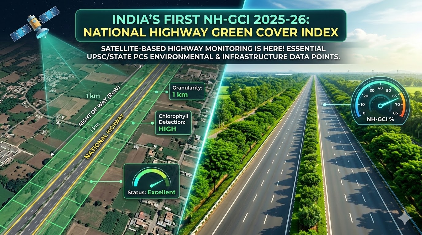
- Satellite-Based Assessment: Leveraging high-resolution satellite sensors, the index measures chlorophyll content to detect actual vegetation presence.
- Scientific Precision: The index provides a percentage value of green cover for every one-kilometer granularity along the Right of Way (RoW).
- Initial Phase Coverage: In the first cycle (July–December 2024), the assessment successfully mapped 30,000 km of National Highways spanning 24 states.
- Transparency & Accountability: This data-driven approach allows the government to rank highway stretches, enabling targeted interventions where plantation is lacking.
What is the Green Cover Index (NH-GCI)?
The NH-GCI is a technology-driven metric that provides a quantitative assessment of vegetation along the National Highways. Instead of relying on manual audits, NHAI now uses high-resolution satellite imagery to measure the actual “greenness” of the highway corridors.
Key Technical Details:
- Collaboration: Developed by NHAI in coordination with the National Remote Sensing Centre (NRSC) of ISRO.
- The Science: The index is derived from chlorophyll content detected through advanced satellite sensors.
- The Metric: It is reported as a percentage value representing the proportion of green cover within the Right of Way (RoW).
- Granularity: Data is analyzed at a scale of 1 km, ensuring hyper-local monitoring.
Why This Matters for Exam Aspirants
1. Shift from Manual to Digital Governance
Previously, plantation monitoring was prone to manual errors and lacked transparency. The NH-GCI uses Space-based technology to provide an objective, macro-level estimation. This aligns with the government’s push for Digital India and Samanvay (inter-agency coordination).
2. Environmental Impact & Climate Goals
Linear plantations along highways are not just for aesthetics. They serve critical ecological functions:
- Carbon Sequestration: Directly contributes to India’s “Net Zero” target by 2070.
- Heat Island Mitigation: Reduces the ambient temperature of asphalt roads.
- Soil Conservation: Prevents erosion on highway embankments.
3. Competitive Federalism
In its first cycle, the report covered 30,000 km across 24 States. By providing a standardized index, the government can now rank states and highway stretches, encouraging a healthy competition to improve green cover year-on-year.
Quick Facts for Prelims 2026
- MoU Period: A three-year agreement signed in January 2024 between NHAI and NRSC (ISRO).
- Data Period: The first assessment cycle used data from July–December 2024.
- The “Right of Way” (RoW): This is the total land area acquired for the highway, including the road and the margins where trees are planted.
- Frequency: The report will be released annually to track progressive improvements.
Essay Angle: “Development vs. Environment”
When writing an essay on sustainable development, the NH-GCI is an excellent “Way Forward” example. It proves that massive infrastructure projects (like the Bharatmala Pariyojana) can coexist with environmental preservation if backed by scientific monitoring and accountability.
“What gets measured, gets managed.” The Green Cover Index ensures that every kilometer of progress on the road is matched by a kilometer of green commitment.
Key Features & Benefits of NH-GCI
The National Highways Green Cover Index serves multiple purposes for the environment and the common citizen:
- Objective Monitoring: Removes human bias in reporting plantation progress by using technology-driven measures.
- Cost-Effective Management: Offers a macro-level estimation that is more time-efficient and cheaper than physical site visits.
- Environmental Transformation: Helps NHAI track the survival rate of plants and monitor progressive improvements year-on-year.
- Pollution Reduction: Better green cover along highways directly contributes to carbon sequestration and noise reduction for nearby residents.
How to Access the NHAI Green Cover Index Report
Citizens, researchers, and environmentalists can easily access the official report following these steps:
- Visit the official website of the National Highways Authority of India (NHAI) at
nhai.gov.in. - Navigate to the ‘Media/Press Release’ or ‘Environmental Initiatives’ section.
- Look for the link titled “Annual Report on NH-GCI 2025-26.”
- Download the PDF to view the state-wise ranking and green cover percentage of your local highways.
NH-GCI 2025-26 Quick Check
Stay Updated: For more crisp summaries of PIB releases and government policies tailored for exam preparation, keep following pibpoints.in.